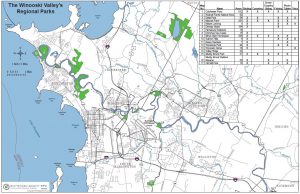
Winooski Valley Park District Parks
Click here for a PDF of the above map: WVPD All Parks Map
It’s Mud Season! With the variable weather Vermont spring brings, natural surface trails will remain and/or become very muddy and wet over the next few weeks. Please avoid muddy trails to help maintain integrity of the trails and prevent further damage to the trail base. It has been a tough few months for our well loved trails! If you encounter muddy areas please turn around or walk through the mud and not around to avoid widening the trails, damaging surrounding vegetation, and increasing the muddy sections.
Park Updates
The December flooding left more silt on the trails than in July. The wet and muddy silt has made many trails along the river more uneven. Please stay away from river edges and banks as erosion and undercutting of the bank has occurred and the river remains high and moving swiftly for this time of year.
Derway Cove, Derway Island & Mayes Landing: Significant shoreline erosion has occurred, please stay away from the river edge. WVPD has rerouted the trail away from the eroded shoreline.
Woodside Natural Area: The two bridges on the Woodside Loop Trail have been displaced several feet up the trail and the Loop Trail is closed. Access to the River directly from the parking area is open. Trail access beyond the displaced bridges is closed. The banks by the displaced bridges are steep and slippery so crossing the stream where the bridge usually rests is not recommended. Frozen conditions and cold temperatures have delayed our ability to replace and fix the bridges, this work may not be possible until spring time.
Colchester Pond: WVPD Crew is in the process of clearing the blowdowns around the loop trail of the pond. Icey conditions, distance to the trees and the large size of many of the trees, is making clean up more difficult and time consuming.
The Winooski Valley Park District owns and manages 18 parks and natural areas consisting of over 1,750 acres of conserved land, 25 miles of trails, and protects 13 miles of shoreline along lakes, rivers, and ponds in the Winooski River Valley. Parks are open to the public free of charge from dawn to dusk each day.
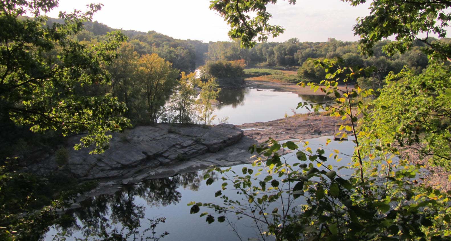
The WVPD’s parks enhance the scenic beauty of its eight member communities and offer opportunities for outdoor recreation close to where people live and work. The parks provide nature trails, scenic overlooks, picnic facilities, cross country skiing trails, canoe and kayak launches, fishing access, and public garden plots. The WVPD’s parks provide residents the opportunity to experience the natural environment with minimal human disturbance.
Please visit our Parks Rules & Regulation Page before enjoying our parks!
WVPD Parks:
For trail maps and further descriptions click on the desired park.
Colchester Pond Natural Area, Colchester
An 182-acre pond and surrounding forest situated within a large tract of contiguous forest. Colchester Pond offers a 3.5-mile walking trail through forest and fields that circles the pond, canoe and kayak access, fishing, picnic areas and wildlife viewing. A favorite spot to visit year-round!
Delta Park, Colchester
A 55-acre park at the mouth of the Winooski River encompassing several diverse ecosystems and a half mile of natural sandy beaches.
Derway Island Nature Preserve, Burlington
A 148-acre nature preserve along the Winooski River with a variety of floodplain ecosystems.
Donahue Sea Caves, Burlington
A 15-acre park covered by cattail marsh, featuring ancient limestone dolomite caves.
Essex Overlook, Essex
Seasonal picnic area off of Rt. 15 with shade trees and picnic tables.
Ethan Allen Homestead, Burlington
A 284-acre park along the Winooski River in Burlington featuring numerous wildlife species, an elevated boardwalk through a cattail marsh, and several miles of trails along the river and through floodplain forests. Visit the Ethan Allen Homestead Museum to tour Ethan and Fanny Allen’s restored 1787 farmhouse. The park is also home to various community gardens and the Winooski Valley Park District offices.
Heineburg Wetlands, Burlington
Undeveloped 12 acres of conserved wetland and floodplain forest along the Winooski River.
Macrae Farm Park, Colchester
A 288-acre park with floodplains, meadows, and upland hardwood forests offering hiking and cross country trails.
Mayes Landing, Burlington
A quiet spot near the mouth of the Winooski River, next to the Burlington Bike Path, featuring a grassy area with picnic tables surrounded by shade trees.
Muddy Brook, South Burlington
A 27.5-acre park in South Burlington featuring several diverse ecosystems, including Winooski River frontage, and a 1.75-mile loop trail.
Muddy Brook Wetland Reserve, South Burlington/Williston
A 48-acre park with constructed and natural wetlands, offering hiking and cross-country ski trails.
Old Mill Park, Jericho
Formerly a beaver pond, Old Mill Park is now an open meadow landscape in Jericho with Clay Brook running through the middle. Enjoy a hike through the white pine dominated forest with views of the Clay Brook along the way.
Salmon Hole Park & Riverwalk Trail, Burlington
Salmon Hole Park lies at the bottom of the Winooski River Falls on the Burlington-Winooski border. Riverwalk Trail follows the Winooski River for about a 1/2 mile to Riverwalk Park on Intervale Road.
Valley Ridge, South Burlington
Currently undeveloped 18-acre natural area with riparian forest along the Winooski River.
Winooski Gorge, South Burlington
Winooski Gorge is an 11-acre natural area in South Burlington featuring a deep river gorge and a Limestone Bluff Cedar-Pine Forest.
Wolcott Family Natural Area, Colchester
Generously donated by the Wolcott Family in 2012, the Wolcott Family Natural Area is a 61.7-acre park featuring a variety of habitats, including marshes and riparian areas along Pond Brook, that flows from Colchester Pond. The park is being developed to have a 1-mile loop trail and accompanying viewing areas to provide educational and passive recreational opportunities.
Woodside Natural Area, Essex
Woodside Natural Area consists of a diversity of habitats, with forest and beaver-impacted wetlands at its center. Enjoy a 1.5-mile loop trail that offers views of the Winooski River and wetlands.


