
January 19, 2024 Update: The rain and snowmelt on 12/18 & 12/19 caused the Winooski River to reach major flood stage for the second time in the last five months, again causing erosion and damage to trails. Please use caution on trails near river edge as erosion and undercutting of the river bank is occurring. The Winooski River remains high and moving swiftly for this time of year. This flood event left more silt and mud along with pools of standing water on some trails – please use caution as trail surfaces may be more uneven and icy.
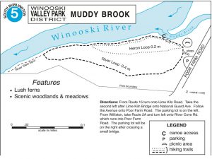
Muddy Brook
Located in South Burlington is 27.5 acres between the Burlington International Airport and the Winooski River.
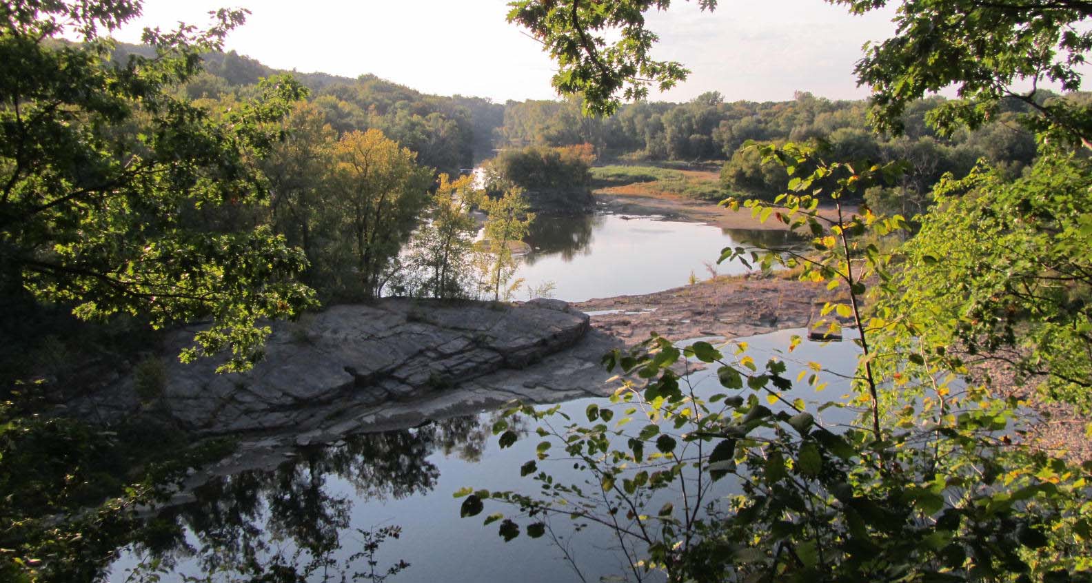
The Muddy Brook, which flows through the park, flows through open agricultural fields to the north and continues through dense vegetation and riparian forest to its mouth where it empties into the Winooski River. Land use planners and ecologists consider this tract of land valuable because it affords unfragmented, contiguous habitat for large ranging mammals such as deer, moose, bear and bobcat. It provides a linkage corridor that many mammals need to move through to other areas where they forage and mate. It also serves as seasonal and year-round home for a myriad of animal, bird and plant species.
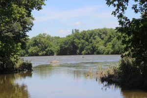
Muddy Brook’s Mouth as it empties into The Winooski River.
It is noteworthy that this park protects several habitats: open land, wetlands, shrublands, shoreline and riparian forest. Because of the varied ecosystems, it is able to support many species. Neighbors of Muddy Brook have informally identified nearly 100 species of birds including Cooper’s hawk, as well as large and small mammals.
The Park District has constructed a loop trail about 1¾ of a mile long, which leads walkers along the river and back along the edge of the field to meet with the trail head. A wooden foot-bridge, fishing access and a picnic area in the forest are features that can be found along the trail.